
Define the water relationship precisely
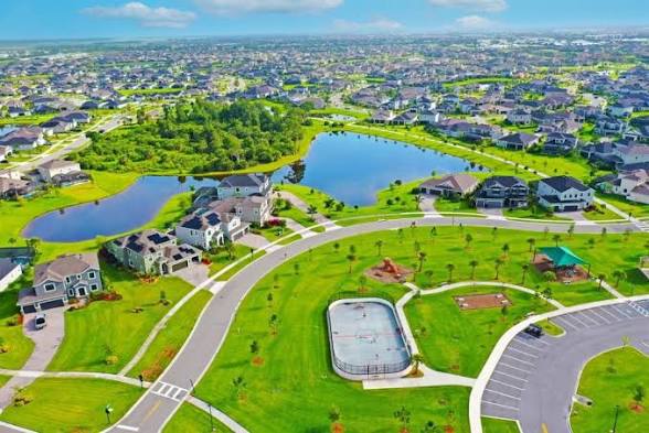
A listing may use lakefront, pond-front, waterfront, water view, preserve view, or similar language. Identify the named or mapped feature when possible, then determine whether it is a stormwater facility, retention or detention area, lake, canal, wetland, conservation feature, or another type of water or open-space element. Marketing language does not establish ownership, access, recreation rights, depth, water quality, permanence, or maintenance.
Match the exact parcel and legal description to the current survey, plats, recorded easements, association and district documents, and responsible public records. Identify where the lot ends, who owns the water or adjacent tract, which improvements cross or approach an easement, and who controls banks, littoral areas, drainage structures, landscaping, fences, docks, walls, or other features. Use a surveyor, attorney, engineer, association, district, or public authority for conclusions within its role.
Investigate drainage, flood, and physical condition separately
A water view does not establish the FEMA flood zone, evacuation information, drainage performance, insurance requirement, or total flood risk. Use the effective FEMA map for orientation, verify the exact property and map date, ask the lender and insurer for current requirements, review available elevation or property records when relevant, and investigate grading, swales, inlets, outfalls, pond relationships, staining, erosion, settlement, and prior repair evidence.
Inspect the home and observable site conditions with qualified professionals. Review disclosures, permits, surveys, drainage plans when available, association or district maintenance information, prior work, insurance questions, and specialist recommendations. A dry visit cannot prove performance during heavy rain, and standing water or vegetation alone does not establish cause, rights, or future behavior.
Verify improvements, use rules, and maintenance
For pools, screen enclosures, patios, fences, seawalls or retaining features when present, irrigation, landscaping, docks or platforms, and shoreline work, verify ownership, permits, association or district approval, boundaries, setbacks, easements, condition, maintenance, insurance treatment, and transfer documents. Do not assume a visible improvement is legal, insurable, included, or replaceable in the same form.
Ask what routine work the owner performs, what another entity maintains, how access for maintenance occurs, and whether current documents address vegetation, fishing, boating, irrigation, pets, lighting, barriers, wildlife interaction, or exterior changes. The answer should come from current controlling material—not a neighbor's recollection or a listing caption.
Compare the view with the whole ownership decision
Place the water relationship beside purchase price, taxes, assessments, association charges, insurance quotes, condition, maintenance, privacy created by current physical features, orientation, outdoor use, mosquito and pest questions routed to qualified sources, exact routes, and resale alternatives. A compelling view should not hide a document gap or an expense the buyer has not accepted.
Views and adjacent conditions can change through vegetation, weather, maintenance, lawful development, water levels, repairs, and other events. Do not promise permanence. Carrie can help compare current Viera properties using neutral criteria and build the evidence request for each finalist; the buyer and responsible professionals decide whether the complete ownership package fits.
Choose your next guide
Review Viera lot drainage and stormwater
Investigate grading, swales, ponds, easements, flood maps, permits, maintenance, and storm observations.
Open guide →Check the FEMA flood map
Use the effective map, panel, date, parcel precision, and lender and insurer questions carefully.
Open guide →Compare Viera property condition
Connect the site to structure, roof, drainage, openings, HVAC, electrical, plumbing, pools, and records.
Open guide →Sources and verification
Last verified September 26, 2026. These links support the verification path. Confirm current, property-specific facts before making a decision.
Questions this page answers
Does a Viera water view mean the home is in a FEMA flood zone?
No. Verify the exact property in the effective FEMA map and separately investigate lender, insurer, drainage, site, elevation, and storm-planning questions.
Does waterfront marketing prove access or ownership?
No. Verify the parcel, survey, plats, easements, governing documents, ownership, maintenance responsibility, and use rules through responsible records and professionals.
Can a water view be guaranteed to remain unchanged?
No. Vegetation, maintenance, weather, water levels, lawful development, repairs, and other conditions can change. Evaluate current evidence without a permanence promise.